Valley Metro
- 4.6
- Rating
- 100.00K
- Installs
- Free
- Price

 Analysis by App-foxy
Getting around the Phoenix metro area by public transportation is easier when route planning starts with the agency that actually runs the network. I spent time with Valley Metro, the official transit app from ValleyMetro, and found that its biggest advantage is focus: it is built for local bus and rail trips rather than trying to be a universal travel tool. That makes it especially useful when your journey begins and ends somewhere within the metro Phoenix area.
The app is free, rated for Everyone, and available for devices running Android or iOS versions supported from OS 10 onward. It has earned a 4.6 average from around 12 thousand ratings, with more than 100 thousand installs, which gives me reasonable confidence that it is a familiar choice for local riders. The current release is version 3.3.0, and the app has been available since June 29, 2021.
How Valley Metro performs when you actually need a trip
I find the most useful way to judge Valley Metro is to look beyond whether a route appears on screen and ask whether I can make a sound decision with it before setting off. For an unfamiliar journey, I would check the boarding point, direction, and transfer while I still have time to reconsider. That preparation also makes it easier to weigh the next question: how much confidence to place in the app when plans change.
You May Also Like

 Blood Strike: 2.5 Anniversary
Blood Strike’s Loadouts Turn Every Drop Into a Tactical Gamble
A close look at Blood Strike’s custom loadouts: how fast access to signature weapons reshapes its battle royale rhythm, rewards preparation, and narrows the gap between fights.

 Pandora - Music & Podcasts
Pandora’s Music Is Easy to Start, but Harder to Recover
Pandora’s strength is its low-effort path from a seed to a station. Its weak spot is how much confidence it asks you to place in connection, setup, and quiet recovery.

 8 Ball Pool
 Is Built on Rivalries, Rematches, and Routine
A close look at the rivalries, rematches, shared routines, and unanswered safety questions that turn a quick pool match into a persistent mobile community.

 Samsung Music
’s Quiet Strength Is Playing What You Already Own
Its reach comes less from spectacle than from dependable access to a personal library. That simplicity is both the app’s strongest retention engine and its ceiling.

 AccuWeather: Weather Radar
AccuWeather Review: A Quick, Clear Forecast for Everyday Decisions
For everyday plans, the best forecast is the one you can understand quickly. AccuWeather makes rain timing, radar, and local conditions easy to act on, with a few trade-offs.

 Hill Climb Racing
Why Hill Climb Racing Still Turns Crashes Into One More Run
A tiny car, a bumpy hill and one more upgrade: Hill Climb Racing keeps resurfacing because its simple chaos makes every near-miss feel personal.
More From Our News Desk



Fast enough for planning, without feeling overloaded
My first impression is that Valley Metro makes sense as a practical starting point rather than a feature-packed travel companion. That distinction matters. A general mapping app may cover walking, driving, cycling, rideshare, and public transportation in one place, but it can also bury the local transit details under a much broader interface. Valley Metro has a narrower job, and that usually helps when I already know I want to take transit.
For a normal trip, I would open it before leaving home, enter the starting point and destination, and use the result to decide whether the proposed journey fits my schedule. The benefit is not just finding a route. It is having a dedicated place to check the public transportation option without first sorting through unrelated travel modes.
Perceived speed depends heavily on the phone, connection, and the amount of information being requested at once, so I would not treat the app as a substitute for leaving early. Still, the focused design makes the planning process feel more direct than switching between a general map and separate transit information. Its real performance strength is reducing decision time, not promising instant travel.
I also like the idea of checking the trip before walking to a stop. In Phoenix, a route that looks simple on a map can involve a meaningful walk, a transfer, or a wait in the heat. Looking at the complete journey first gives me a chance to choose better clothing, carry water, or decide that another option is more sensible for that particular day.
A realistic weekday use case
Imagine leaving work for an appointment across the metro area. I would use Valley Metro while still indoors, check the suggested transit journey, and note the first boarding point and any transfer involved. If the trip includes a connection, I would avoid treating the arrival time as exact. Instead, I would build in room for walking between platforms or stops and for the possibility that the first vehicle is crowded or delayed.
That workflow is more useful than simply searching once and closing the app. I would check the route before leaving, then open it again shortly before boarding. If the journey is unfamiliar, I would keep the phone accessible during the transfer rather than assuming that the first result remains ideal after conditions change.
A less obvious benefit is that this approach helps separate planning from navigation. I can use the app to understand the transit structure, then use my surroundings to confirm that I am at the right stop. That small habit reduces the chance of walking past a boarding point while staring only at a screen.
Where it helps during heavy-use moments
The app becomes more valuable when I am making several transit decisions in a short period. A single trip from a familiar neighborhood may not require much help, but a day involving work, shopping, and an appointment can create several points where the best route changes. Valley Metro gives me a dedicated tool for revisiting those choices instead of relying on memory.
Heavy use also exposes the difference between a transit-specific app and a general alternative. A broad mapping service may be better when I need to combine a car ride with walking or compare public transportation against driving. Valley Metro is more appropriate when the question is simply, “How do I make this trip using the local network?” I would choose the general map for a mixed-mode journey and Valley Metro for a transit-first one.
There is a practical trade-off here. A dedicated app can be clearer because it avoids unrelated information, but it may feel less useful when my trip starts outside the Valley Metro service area or ends somewhere that requires another transportation provider. In those cases, I would not force it to solve the entire journey. I would use it for the Valley Metro portion and another tool for the rest.
Stability matters more than visual extras
For a navigation app, stability is more important to me than decorative design. I want the route screen to remain understandable, the app to recover if I briefly lose connectivity, and the phone to stay usable while I am walking. Valley Metro’s value is therefore tied to dependable access at the moment I need a trip decision.
I would still prepare for weak signal in the same way I prepare for any transit journey: check the route before entering an underground or crowded area, remember the key stop names, and avoid depending on a live screen as my only source of orientation. This is not a criticism unique to Valley Metro. It is a sensible habit for any app that sits between a changing transport network and a battery-powered phone.
Recovery is also part of reliability. If I close the app, move to another screen, or need to reconsider the destination, I expect to be able to restart the search without confusion. My preferred workflow is to keep the essential details in mind: boarding location, direction of travel, transfer point, and destination stop. That way, even if I need to reopen the app, I am not starting from zero.
One useful discipline is to verify the direction of travel rather than focusing only on the stop name. Similar names or nearby stops can be easy to confuse, especially when I am in a hurry. Valley Metro can guide the planning, but I still need to read the result carefully and match it with the signs around me.
Resource demands and device constraints
Valley Metro is not the kind of app I would install for entertainment or leave open all day. I would open it when planning a journey, check the relevant information, and close it when I no longer need it. That short-session pattern should suit people who want a focused transit tool rather than another constantly active application.
Compatibility begins at OS 10, so anyone using an older phone should check the device requirement before relying on it. On a supported device, the more important constraint is likely to be practical: battery level, available connection, screen visibility, and whether the phone is comfortable to use while walking. A large route map can be harder to read outdoors, and a low battery can turn even a good plan into a stressful one.
I recommend opening the app before leaving a reliable Wi-Fi connection when the trip is unfamiliar. That gives me time to inspect the route calmly instead of trying to make decisions beside a busy stop. I would also reduce screen brightness only after confirming that I can still read the route, because conserving power is useful but losing visual clarity is not.
Another small but important tip is to avoid repeatedly refreshing a route without a reason. If I am checking the same journey every few seconds, I am spending attention and battery without necessarily gaining a better decision. I would refresh when I have a clear reason, such as a changed departure time or a revised destination, and otherwise concentrate on getting to the correct boarding point.
Who will appreciate the focused approach
Valley Metro is a good fit for local residents, students, workers, visitors staying in the Phoenix metro area, and anyone who wants the official transit-focused option for planning journeys. It is especially suitable for people who do not want driving directions mixed into every search. The free price also makes it easy to try without committing to a subscription or paid navigation product.
I can also see it helping occasional riders who understand the destination but are unsure about the transit process. Rather than memorizing the whole network, they can use the app to break a journey into manageable pieces. The most useful habit is to inspect the transfer before starting, because that is where an unfamiliar trip is most likely to become confusing.
On the other hand, I would skip it as my only navigation tool if I regularly travel far beyond the Phoenix metro area, need detailed driving and walking comparisons, or combine several transport providers in one itinerary. A general mapping service may be better for those situations. Valley Metro is strongest when the local public transportation network is the center of the trip.
How it compares with familiar alternatives
Compared with a standard maps app, Valley Metro feels more specialized. The general alternative wins when I want one place to compare driving, walking, cycling, and transit, or when my route crosses multiple regions. Valley Metro wins when I want a transit-first search that stays relevant to the Phoenix area.
Compared with checking a website in a mobile browser, the app is more convenient for repeated use. I do not need to begin every trip by finding the correct transit page, and the dedicated format makes it easier to return to the same kind of task. The trade-off is that a browser can be more flexible when I am using a shared device or do not want another app installed.
Compared with relying on printed information or asking someone at a stop, Valley Metro gives me more control over the planning process. I can reconsider the destination, compare possible journeys, and prepare before I leave. But I would not let that convenience replace basic awareness. If a stop looks different from what I expected, I would pause and verify rather than blindly follow the phone.
Small habits that make the app more useful
My preferred method is to plan in three passes. First, I check the complete route at home. Second, I confirm the starting point shortly before leaving. Third, I review the transfer or final stop when I am already on the way. This avoids both extremes: leaving with no plan and staring continuously at the app throughout the trip.
For an unfamiliar destination, I would save mental notes rather than relying on a screenshot alone. The important details are the direction, the transfer, and the stop where I should get off. A screenshot can become outdated if I change the departure time, while a short written reminder helps me recognize whether the route still makes sense.
I would also use Valley Metro to compare convenience, not just duration. A slightly longer trip with fewer transfers may be easier on a hot day or when carrying bags. A shorter result may demand more walking or a tighter connection. The best route is not always the one with the smallest number on the screen; it is the one that matches my energy, luggage, weather, and familiarity with the area.
Finally, I would treat the app as a planning partner rather than an authority that removes all responsibility. Transit conditions can change, and a phone cannot judge whether a stop feels safe, comfortable, or easy to find in the moment. Combining the route result with visible signs and local awareness is the most dependable way to use it.
My performance verdict
After using Valley Metro as a focused local transit tool, I see its appeal clearly. It is free, officially developed by ValleyMetro, and aimed at the exact kind of trip where a broad navigation app can feel unnecessarily busy. Its strong rating and install base suggest that it has found a useful place among Phoenix-area riders, while the Everyone age rating makes it approachable for a wide audience.
I would recommend it to anyone whose regular journeys depend on public transportation in the metro Phoenix area. The app is most effective when I use it before leaving, inspect transfers carefully, and keep a simple backup understanding of the route. That workflow makes the experience feel calmer and reduces the risk of being caught unprepared by a confusing connection.
My reservation is about scope rather than the basic idea. People who need nationwide travel planning, multi-provider itineraries, or detailed comparisons with driving may prefer a broader maps application. Valley Metro is not the right choice for every transportation question, but that narrow focus is also why it works well for its intended audience.
In the end, I would keep Valley Metro installed if I lived in or regularly visited the Phoenix metro area and wanted a straightforward way to plan local transit trips. It does not need to replace every navigation tool on my phone. It simply needs to make the public transportation part of the journey easier to understand, and that is where I find it most useful.
FAQs for Valley Metro
01What services does the Valley Metro app offer?
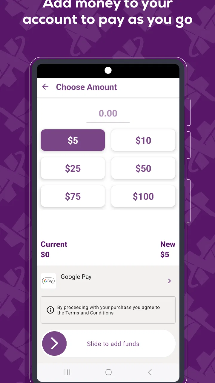
The Valley Metro app provides a comprehensive range of services for public transit users in the Phoenix metropolitan area. It offers real-time bus and train schedules, trip planning, fare purchasing, and service alerts. Users can also access maps and route information, making it a one-stop solution for all transit needs.
02How user-friendly is the Valley Metro app for first-time users?
The Valley Metro app is designed with a user-friendly interface, making it accessible for first-time users. The intuitive layout allows users to easily navigate through options like trip planning and schedule checking. Tutorials and help sections are also available to assist new users in understanding and utilizing all features effectively.
03Can I purchase and store tickets directly in the Valley Metro app?
Yes, the Valley Metro app allows users to purchase and store tickets directly within the app. This feature provides a convenient, paperless way to manage fares. Users can buy single, day, or monthly passes and store them securely, ensuring easy access during transit without the need for physical tickets.
04Does the Valley Metro app provide real-time updates and alerts?
The app offers real-time updates and alerts, keeping users informed of any changes or disruptions in service. Notifications about delays, cancellations, and route changes are sent directly to users' devices, allowing them to make informed decisions and adjustments to their travel plans promptly.
05Is the Valley Metro app compatible with both Android and iOS devices?
Yes, the Valley Metro app is compatible with both Android and iOS devices. It can be downloaded from the Google Play Store for Android users and the Apple App Store for iOS users. The app is regularly updated to ensure compatibility with the latest operating systems and devices.
Pros
- User-friendly interface
- easy navigation.
- Real-time updates on bus and train schedules.
- Integrated trip planner for seamless travel.
- Comprehensive route details and maps.
- Customizable notifications for service alerts.
Cons
- Limited offline functionality.
- Occasional inaccuracies in schedule updates.
- Requires constant GPS for accurate tracking.
- Battery consumption can be high.
- No dark mode for night-time use.

Valley Metro
Gallery